Hariahera: Difference between revisions
Jump to navigation
Jump to search
(Replaced content with "<PhpTags village_id=245713 />") Tags: Replaced Reverted |
No edit summary Tag: Manual revert |
||
| Line 1: | Line 1: | ||
< | '''Hariahera''' village is located in Sohna tehsil of Gurgaon district in Haryana, India. It is situated 9km away from sub-district headquarter Sohna (tehsildar office) and 21km away from district headquarter Gurgaon. As per 2009 stats, Hariyaheda is the gram panchayat of Hariahera village. | ||
<div style="float:right; width: 20%;"> | |||
/> | {| class="wikitable style="width:100%" | ||
! colspan="2" style="font-size: 14px; font-weight: bold; | Hariahera - Village Overview | |||
|- | |||
| Gram Panchayat : | |||
| Hariahera | |||
|- | |||
| Block / Tehsil : | |||
| Sohna | |||
|- | |||
| District : | |||
| Gurgaon | |||
|- | |||
| State : | |||
| Haryana | |||
|- | |||
| Pincode : | |||
| 122102 | |||
|- | |||
| Area : | |||
| 338 hectares | |||
|- | |||
| Population : | |||
| 1503 | |||
|- | |||
| Updated Population : | |||
| 2500(2023) | |||
|- | |||
| Households : | |||
| 270 | |||
|- | |||
| Assembly Constituency : | |||
| Sohna | |||
|- | |||
| Parliament Constituency : | |||
| Gurgaon | |||
|} | |||
</div> | |||
<big><big>'''Panchayat'''</big></big> | |||
;* <big>'''Demographic'''</big> | |||
:-''' Total Population''' | |||
::2052(2011) | |||
:-''' Male''' | |||
::1200 | |||
:-''' Female''' | |||
::1300 | |||
:-''' Sex Ratio - Ratio of: 1000''' | |||
::92 | |||
:-''' No. of Voters''' | |||
::897(2023) | |||
:-''' Updated Population''' | |||
::2500(2023) | |||
;* <big>'''Historical'''</big> | |||
:-''' History of Village''' | |||
:: | |||
;* <big>'''Current Panchayat'''</big> | |||
:- '''Sarpanch''' | |||
::Mrs. Priyanka | |||
::9416995721 | |||
:- '''Panch''' | |||
::Mr. Rajinder Saini | |||
::Mrs. Nisha | |||
::Mrs. Sudesh | |||
::Mr. Dashrat | |||
::Mr. Rehan | |||
::Mrs. Aisha | |||
::Mr. Sachin Yadav | |||
::Mrs. Megha | |||
;* <big>'''Old Panchayat Body'''</big> | |||
::Mr. Abdul Sattar | |||
;* <big>'''Eminent Person'''</big> | |||
:- '''Eminent Person''' | |||
::NA | |||
:- '''Sports''' | |||
:: | |||
:- '''Political''' | |||
:: | |||
:- '''Govt. Services''' | |||
:: | |||
:- '''Armed Forces/Freedom Fighters''' | |||
:: | |||
:- '''Industrialist''' | |||
:: | |||
:- '''NRI''' | |||
:: | |||
:- '''Religious Sect Head''' | |||
:: | |||
;* <big>'''Administrative Staff'''</big> | |||
:- '''Gram Sachiv''' | |||
::Mr. Umesh kumar | |||
::9971246888 | |||
:- '''Sarpanch''' | |||
::Mrs. Priyanka | |||
::9416995721 | |||
:- '''VLDA''' | |||
:: | |||
:- '''Revenue Patwari''' | |||
:: Mr. Satpal yadav | |||
:- '''ADO''' | |||
:: | |||
:- '''Forest Ranger''' | |||
:: | |||
:- '''Asha Worker''' | |||
::Mrs. Suman | |||
::Mrs. Asha Devi | |||
:- '''Principal''' | |||
::Mrs. Rajita | |||
::Mrs. Rajkumari | |||
:- '''Anganwadi Incharge''' | |||
::Mrs. Rajita | |||
::Mrs. Rajkumari | |||
:- '''Lineman''' | |||
::Mr. Sunil | |||
:- '''Tubewell Operator''' | |||
::Mr. Joginder | |||
:- '''Chowkidar''' | |||
::Mr. Vakeel | |||
:- '''JE Panchayati Raj''' | |||
::Mr. Sunil Jain | |||
:- '''JE Public Health Department''' | |||
::Mr. Ankit | |||
:- '''JE Irrigation''' | |||
::Mr. Sumit | |||
;* <big>'''Geography Of Hariahera'''</big> | |||
:- '''East''' | |||
:: | |||
:- '''West''' | |||
:: | |||
:- '''North''' | |||
:: | |||
:- '''South''' | |||
:: | |||
:- '''Water Level''' | |||
:: | |||
;* <big>'''Self Help Group'''</big> | |||
:- '''Famous Product manufactured''' | |||
: | |||
;* <big>'''Youth Club'''</big> | |||
:: | |||
;* <big>'''Livestock'''</big> | |||
:- '''Majority Type of Animals''' | |||
::buffalo | |||
:- '''Variety of animal''' | |||
::3(cow, Buffalo, goat) | |||
;<big><big>'''Tourist Spot'''</big></big> | |||
:: | |||
;<big><big>'''Agriculture'''</big></big> | |||
::Products, Soil Maps, crops, Farmer Data, Soil Health data, irrigation source, Crop Pattern, Land holding | |||
::wheat, bajara | |||
<big><big>'''Infrastructure'''</big></big> | |||
;* <big>'''Ponds'''</big> | |||
[[File:20230530 40523PMByGPSMapCamera.jpg|thumb]] | |||
:- '''Wet''' | |||
::1 | |||
::- '''Pond 1''' | |||
:::- '''Area as per Revenue Record''' | |||
::::'''Source Link: '''http://hpwwma.org.in | |||
:::- '''Actual Area at Site (in acre)''' | |||
::::1.80 | |||
:::- '''Latitude (in Deg-Min-Sec)''' | |||
::::28°18'27''N | |||
:::- '''Longitude (in Deg-Min-Sec)''' | |||
::::77°03'00''E | |||
:::- '''Whether the Pond is WETLAND as Identified by HARSAC''' | |||
::::No | |||
:::- '''Source of filling the Pond''' | |||
::::Rain Fed | |||
:::- '''Details of Encroachments on the Pond''' | |||
::::No | |||
:::- '''Whether the Pond is in Abadi Area''' | |||
::::Yes | |||
:::- '''Remarks''' | |||
::::Scheme: Amrit-Sarovar Dep.:(PR-PW) Year:2022-23 | |||
[[File:20230530 34338PMByGPSMapCamera.jpg|thumb]] | |||
:- '''Dry''' | |||
::1 | |||
::- '''Pond 1''' | |||
:::- '''Area as per Revenue Record''' | |||
::::'''Source Link: '''http://hpwwma.org.in | |||
:::- '''Actual Area at Site (in acre)''' | |||
::::1.00 | |||
:::- '''Latitude (in Deg-Min-Sec)''' | |||
::::28°18'21''N | |||
:::- '''Longitude (in Deg-Min-Sec)''' | |||
::::77°02'28''E | |||
:::- '''Whether the Pond is WETLAND as Identified by HARSAC''' | |||
::::No | |||
:::- '''Source of filling the Pond''' | |||
::::Rain Fed | |||
:::- '''Details of Encroachments on the Pond''' | |||
:::: | |||
:::- '''Whether the Pond is in Abadi Area''' | |||
::::No | |||
:::- '''Remarks''' | |||
::::Pond is to be digging by MGNREGA | |||
;* <big>'''Streets'''</big> | |||
:-''' Kacchi''' | |||
:: | |||
:-''' Pakki''' | |||
:: | |||
;* <big>'''Land'''</big> | |||
:: | |||
;* <big>'''Assets'''</big> | |||
:: | |||
;* <big>'''Buildings'''</big> | |||
[[File:20230530 347003PMByGPSMapCamera.jpg|thumb]] | |||
[[File:20230530 350011PMByGPSMapCamera.jpg|thumb]] | |||
::S.C Chaupal | |||
::V.C Chaupal | |||
;* <big>'''Death rituals'''</big> | |||
[[File:20230530 400244PMByGPSMapCamera.jpg|thumb]] | |||
:- '''Shamshanghat''' | |||
::1 | |||
[[File:20230530 340055PMByGPSMapCamera.jpg|thumb]] | |||
[[File:20230530 340019PMByGPSMapCamera.jpg|thumb]] | |||
:- '''Kabristan''' | |||
::2 | |||
;* <big>'''Religious Places '''</big> | |||
[[File:20230530 35943PMByGPSMapCamera.jpg|thumb]] | |||
:- '''Mandir''' | |||
::1 | |||
:-''' Masjid''' | |||
:: | |||
:-''' Church''' | |||
:: | |||
:-''' Gurudwara''' | |||
:: | |||
:-''' Khera''' | |||
:: | |||
;* <big>'''Layout plans'''</big> | |||
:: | |||
;* <big>'''Stadiums '''</big> | |||
:: | |||
;* <big>'''Parks'''</big> | |||
:: | |||
;* <big>'''Gyms '''</big> | |||
:: | |||
;* <big>'''Library'''</big> | |||
:: | |||
;* <big>'''Mobile Towers '''</big> | |||
[[File:202300530 35546PMByGPSMapCamera.jpg|thumb]] | |||
::1 | |||
;* <big>'''BharatNet'''</big> | |||
:: | |||
;* <big>'''Substation (Electricity)'''</big> | |||
:: | |||
;* <big>'''Electricity Poles '''</big> | |||
:: | |||
;* <big>'''Industrial Infra'''</big> | |||
:: | |||
;* <big>'''Post offices'''</big> | |||
::2 | |||
<big><big>'''Education'''</big></big> | |||
[[File:202300530 35139PMByGPSMapCamera.jpg|thumb]] | |||
[[File:20230530 338270PMByGPSMapCamera.jpg|thumb]] | |||
;* <big>'''Anganwadi'''</big> | |||
:-''' Anganwadi Incharge''' | |||
::2 | |||
:-''' Anganwadi Code''' | |||
::501, 502 | |||
:-''' Anganwadi Staff''' | |||
::501: Mrs. Rajita | |||
::502: Mrs. Rajkumari | |||
:-''' Anganwadi Strength''' | |||
::14, 12 | |||
:-''' Anganwadi Helper''' | |||
::Mrs. Jamsheela | |||
::Mrs. Savitri | |||
;* <big>'''Primary School'''</big> | |||
[[File:20230530 325009PMByGPSMapCamera.jpg|thumb]] | |||
[[File:20230530 331190PMByGPSMapCamera.jpg|thumb]] | |||
::1(Girls)(boys) | |||
::'''Principal:''' Mrs. Suman Dahiya | |||
::'''Teacher:''' 4 | |||
:::Mrs. Chandni | |||
:::Mrs. Neetu Singla | |||
:::Mrs. Poonam Rani | |||
:::Mrs. Meenakshi yadav | |||
::'''Total Strength:''' 85 | |||
::'''Chowkidar:''' Mr. Prabhu Dayal | |||
;* <big>'''Secondary School'''</big> | |||
[[File:20230530 326005PMByGPSMapCamera.jpg|thumb]] | |||
::1 | |||
::'''Principal:''' Mrs. Suman Dahiya | |||
::'''Teacher:''' 5 | |||
:::Mrs. Suman Dahiya | |||
:::Mr. Parmod kumar | |||
:::Mrs. Gurmeet Kaur | |||
:::Mr. Suraj Bhanshastri | |||
:::Mr. Parvesh kumar | |||
::'''Total Strength:''' 115 | |||
;* <big>'''Colleges '''</big> | |||
:: | |||
;* <big>'''Tuition Teachers '''</big> | |||
:: | |||
;* <big>'''ITI '''</big> | |||
:: | |||
;* <big>'''University'''</big> | |||
:: | |||
;* <big>'''Coaching Centre'''</big> | |||
:: | |||
;* <big>'''Student Profile'''</big> | |||
:: | |||
<big><big>'''Industry'''</big></big> | |||
;* <big>'''Type of Industries based on size'''</big> | |||
:: | |||
;* <big>'''Type of Industries based on domain / product'''</big> | |||
:: | |||
;* <big>'''Work force Type'''</big> | |||
:: | |||
<big><big>'''Health'''</big></big> | |||
;* <big>'''Hospitals'''</big> | |||
:: | |||
;* <big>'''Dispensaries '''</big> | |||
:: | |||
;* <big>'''CHC'''</big> | |||
:: | |||
;* <big>'''PHC'''</big> | |||
:: | |||
;* <big>'''Sub-health centers'''</big> | |||
:: | |||
;* <big>'''Facilities'''</big> | |||
:: | |||
;* <big>'''Medical stores with Timing'''</big> | |||
:: | |||
;* <big>'''Chemist shops'''</big> | |||
:: | |||
;* <big>'''Colleges '''</big> | |||
:: | |||
;* <big>'''Mal-Nutritions Data'''</big> | |||
:: | |||
;* <big>'''Pregnant Women Data'''</big> | |||
:: | |||
;* <big>'''Juvenile Committees'''</big> | |||
:: | |||
<big><big>'''Banks'''</big></big> | |||
;* <big>'''Banks with branches'''</big> | |||
:: | |||
;* <big>'''ATMâs'''</big> | |||
:: | |||
;* <big>'''Financial Institutions'''</big> | |||
:: | |||
;* <big>'''Non Financial Institutions'''</big> | |||
:: | |||
;* <big>'''Business Correspondents'''</big> | |||
:: | |||
<big><big>'''Social'''</big></big> | |||
;* <big>'''Old Age Pension'''</big> | |||
:: | |||
;* <big>'''Disabled Pension'''</big> | |||
:: | |||
;* <big>'''Scholarships'''</big> | |||
:: | |||
;* <big>'''Ration Card'''</big> | |||
:: | |||
;* <big>'''BPL Card'''</big> | |||
:: | |||
;* <big>'''Chirayu Card'''</big> | |||
:: | |||
;* <big>'''ESI Card'''</big> | |||
:: | |||
<big><big>'''Bio Diversity'''</big></big> | |||
;* <big>'''Flora Species'''</big> | |||
::wheat, bazra, mustard | |||
<big><big>'''Commercial / Business'''</big></big> | |||
;* <big>'''Shops'''</big> | |||
:- '''General Store''' | |||
:: | |||
:- '''Hardware''' | |||
:: | |||
:- '''Seeds''' | |||
:: | |||
:- '''Grocery''' | |||
:: | |||
:- '''Textile''' | |||
:: | |||
;* <big>'''Showrooms'''</big> | |||
:: | |||
;* <big>'''Warehouses'''</big> | |||
:: | |||
;* <big>'''Cold Storage'''</big> | |||
:: | |||
;* <big>'''Courier/Postal'''</big> | |||
::pin: 122103 | |||
;* <big>'''Resort/Hotel'''</big> | |||
:: | |||
<big><big>'''Supply Chain Management'''</big></big> | |||
;* <big>'''Hafed/Other'''</big> | |||
:: | |||
<big><big>'''Aquifer Information'''</big></big> | |||
;* <big>'''General Information'''</big> | |||
:- '''Geographical area :''' | |||
:: | |||
:- '''Basin/Sub basin :''' | |||
:: | |||
:- '''Principal Aquifer system :''' | |||
:: | |||
:- '''Major Aquifer System :''' | |||
:: | |||
:- '''Normal Annual Rainfall :''' | |||
:: | |||
;* <big>'''Aquifer Disposition'''</big> | |||
:- '''Aquifer Disposition :''' | |||
:: | |||
:- '''Status of GW Exploration :''' | |||
:: | |||
:- '''Aquifer Characteristics :''' | |||
:: | |||
:- '''CGWB Monitoring Status :''' | |||
:: | |||
:- '''GW Quality :''' | |||
:: | |||
:- '''Aquifer Potential :''' | |||
:: | |||
;* <big>'''Aquifer Management Plan'''</big> | |||
:- '''GW Management Issues :''' | |||
:: | |||
:- '''GW Resource :''' | |||
:: | |||
:- '''GW Stage of Development (%) :''' | |||
:: | |||
:- '''Existing and Future Water Demand :''' | |||
:: | |||
:- '''GW Management Plan :''' | |||
:: | |||
:- '''AR & Conservation Possibilities:''' | |||
:: | |||
<big><big>'''How to reach?'''</big></big></br> | |||
'''Source links on below ''' | |||
{| class="wikitable" | |||
|- | |||
! Place !! Type !! Lat-Long !! Link | |||
|- | |||
|rowspan="2"| Ponds | |||
|Wet || 28.30786276687813, 77.05065474759715 || https://goo.gl/maps/4qoFLB9zDueuhqTx9 | |||
|- | |||
|Dry || 28.30607511225958, 77.04127216371919 || https://goo.gl/maps/zCgiVKzqMJ5pqNBR8 | |||
|- | |||
|rowspan="2"|Streets | |||
|Kacchi || - || - | |||
|- | |||
|Pakki || - || - | |||
|- | |||
| Land || || - || - | |||
|- | |||
| Assets || || - || - | |||
|- | |||
| rowspan="2"| Buildings | |||
|| || 28.30646253652179, 77.0465872766935 || https://goo.gl/maps/KxYWonLT65Z64JkX8 | |||
|- | |||
|| || 28.306069261965366, 77.0479812923901 || https://goo.gl/maps/YrFqRYufL4kg2ows6 | |||
|- | |||
| rowspan="2"| Death rituals | |||
| Shamshanghat || 28.308788654827012, 77.05178241138105 || https://goo.gl/maps/hQ7C6X3e2Qy987w86 | |||
|- | |||
| Kabristan || 28.306501216126172, 77.04011503863342 || https://goo.gl/maps/gxbHcBTbswxf3Mzg9 | |||
|- | |||
| rowspan="5"| Religious Places | |||
| Mandir || 28.307281074025585, 77.04932851770752 || https://goo.gl/maps/PUpAeR1QTbZN7CAZ6 | |||
|- | |||
| Masjid|| - || - | |||
|- | |||
| Church|| - || - | |||
|- | |||
| Gurudwara || - || - | |||
|- | |||
| Khera || - || - | |||
|- | |||
| Layout plans || || - || - | |||
|- | |||
| Stadiums || || - || - | |||
|- | |||
| Parks || || - || - | |||
|- | |||
| Gyms || || - || - | |||
|- | |||
| Library || || - || - | |||
|- | |||
| Mobile Towers || || 28.30526952818239, 77.04871062984031 || https://goo.gl/maps/FUc9DNda4Lgw3Xyq7 | |||
|- | |||
| BharatNet || || - || - | |||
|- | |||
| Substation (Electricity) || || - || - | |||
|- | |||
| Electricity Poles || || - || - | |||
|- | |||
| Industrial Infra || || - || - | |||
|- | |||
| Post offices || || - || - | |||
|} | |||
:: | |||
<big><big><strong style="color: blue;">Village Requirement Hariahera</strong></big></big> | |||
:: | |||
{| class="wikitable" | |||
|+ | |||
!<big><big><strong style="color: black;">Sr.No </strong></big></big> | |||
!<big><big><strong style="color: black;">Requirement Description</strong></big></big> | |||
!<big><big><strong style="color: black;">Published Date</strong></big></big> | |||
!<big><big><strong style="color: black;">Quantity</strong></big></big> | |||
!<big><big><strong style="color: black;">Estimated Amount</strong></big></big> | |||
!<big><big><strong style="color: black;">Requirement Applicable </strong></big></big> | |||
!<big><big><strong style="color: black;">Status</strong></big></big> | |||
|- | |||
|1 | |||
| | |||
| | |||
| | |||
| | |||
| | |||
|- | |||
|2 | |||
| | |||
| | |||
| | |||
| | |||
| | |||
| | |||
|- | |||
|3 | |||
| | |||
| | |||
| | |||
| | |||
| | |||
| | |||
|- | |||
|4 | |||
| | |||
| | |||
| | |||
| | |||
| | |||
| | |||
|- | |||
|} | |||
Revision as of 11:43, 28 December 2023
Hariahera village is located in Sohna tehsil of Gurgaon district in Haryana, India. It is situated 9km away from sub-district headquarter Sohna (tehsildar office) and 21km away from district headquarter Gurgaon. As per 2009 stats, Hariyaheda is the gram panchayat of Hariahera village.
| Hariahera - Village Overview | |
|---|---|
| Gram Panchayat : | Hariahera |
| Block / Tehsil : | Sohna |
| District : | Gurgaon |
| State : | Haryana |
| Pincode : | 122102 |
| Area : | 338 hectares |
| Population : | 1503 |
| Updated Population : | 2500(2023) |
| Households : | 270 |
| Assembly Constituency : | Sohna |
| Parliament Constituency : | Gurgaon |
Panchayat
- Demographic
- - Total Population
- 2052(2011)
- - Male
- 1200
- - Female
- 1300
- - Sex Ratio - Ratio of: 1000
- 92
- - No. of Voters
- 897(2023)
- - Updated Population
- 2500(2023)
- Historical
- - History of Village
- Current Panchayat
- - Sarpanch
- Mrs. Priyanka
- 9416995721
- - Panch
- Mr. Rajinder Saini
- Mrs. Nisha
- Mrs. Sudesh
- Mr. Dashrat
- Mr. Rehan
- Mrs. Aisha
- Mr. Sachin Yadav
- Mrs. Megha
- Old Panchayat Body
-
- Mr. Abdul Sattar
- Eminent Person
- - Eminent Person
- NA
- - Sports
- - Political
- - Govt. Services
- - Armed Forces/Freedom Fighters
- - Industrialist
- - NRI
- - Religious Sect Head
- Administrative Staff
- - Gram Sachiv
- Mr. Umesh kumar
- 9971246888
- - Sarpanch
- Mrs. Priyanka
- 9416995721
- - VLDA
- - Revenue Patwari
- Mr. Satpal yadav
- - ADO
- - Forest Ranger
- - Asha Worker
- Mrs. Suman
- Mrs. Asha Devi
- - Principal
- Mrs. Rajita
- Mrs. Rajkumari
- - Anganwadi Incharge
- Mrs. Rajita
- Mrs. Rajkumari
- - Lineman
- Mr. Sunil
- - Tubewell Operator
- Mr. Joginder
- - Chowkidar
- Mr. Vakeel
- - JE Panchayati Raj
- Mr. Sunil Jain
- - JE Public Health Department
- Mr. Ankit
- - JE Irrigation
- Mr. Sumit
- Geography Of Hariahera
- - East
- - West
- - North
- - South
- - Water Level
- Self Help Group
- - Famous Product manufactured
- Youth Club
-
- Livestock
- - Majority Type of Animals
- buffalo
- - Variety of animal
- 3(cow, Buffalo, goat)
- Tourist Spot
-
- Agriculture
-
- Products, Soil Maps, crops, Farmer Data, Soil Health data, irrigation source, Crop Pattern, Land holding
- wheat, bajara
Infrastructure
- Ponds

- - Wet
- 1
- - Pond 1
- - Area as per Revenue Record
- Source Link: http://hpwwma.org.in
- - Area as per Revenue Record
- - Actual Area at Site (in acre)
- 1.80
- - Actual Area at Site (in acre)
- - Latitude (in Deg-Min-Sec)
- 28°18'27N
- - Latitude (in Deg-Min-Sec)
- - Longitude (in Deg-Min-Sec)
- 77°03'00E
- - Longitude (in Deg-Min-Sec)
- - Whether the Pond is WETLAND as Identified by HARSAC
- No
- - Whether the Pond is WETLAND as Identified by HARSAC
- - Source of filling the Pond
- Rain Fed
- - Source of filling the Pond
- - Details of Encroachments on the Pond
- No
- - Details of Encroachments on the Pond
- - Whether the Pond is in Abadi Area
- Yes
- - Whether the Pond is in Abadi Area
- - Remarks
- Scheme: Amrit-Sarovar Dep.:(PR-PW) Year:2022-23
- - Remarks

- - Dry
- 1
- - Pond 1
- - Area as per Revenue Record
- Source Link: http://hpwwma.org.in
- - Area as per Revenue Record
- - Actual Area at Site (in acre)
- 1.00
- - Actual Area at Site (in acre)
- - Latitude (in Deg-Min-Sec)
- 28°18'21N
- - Latitude (in Deg-Min-Sec)
- - Longitude (in Deg-Min-Sec)
- 77°02'28E
- - Longitude (in Deg-Min-Sec)
- - Whether the Pond is WETLAND as Identified by HARSAC
- No
- - Whether the Pond is WETLAND as Identified by HARSAC
- - Source of filling the Pond
- Rain Fed
- - Source of filling the Pond
- - Details of Encroachments on the Pond
- - Details of Encroachments on the Pond
- - Whether the Pond is in Abadi Area
- No
- - Whether the Pond is in Abadi Area
- - Remarks
- Pond is to be digging by MGNREGA
- - Remarks
- Streets
- - Kacchi
- - Pakki
- Land
-
- Assets
-
- Buildings
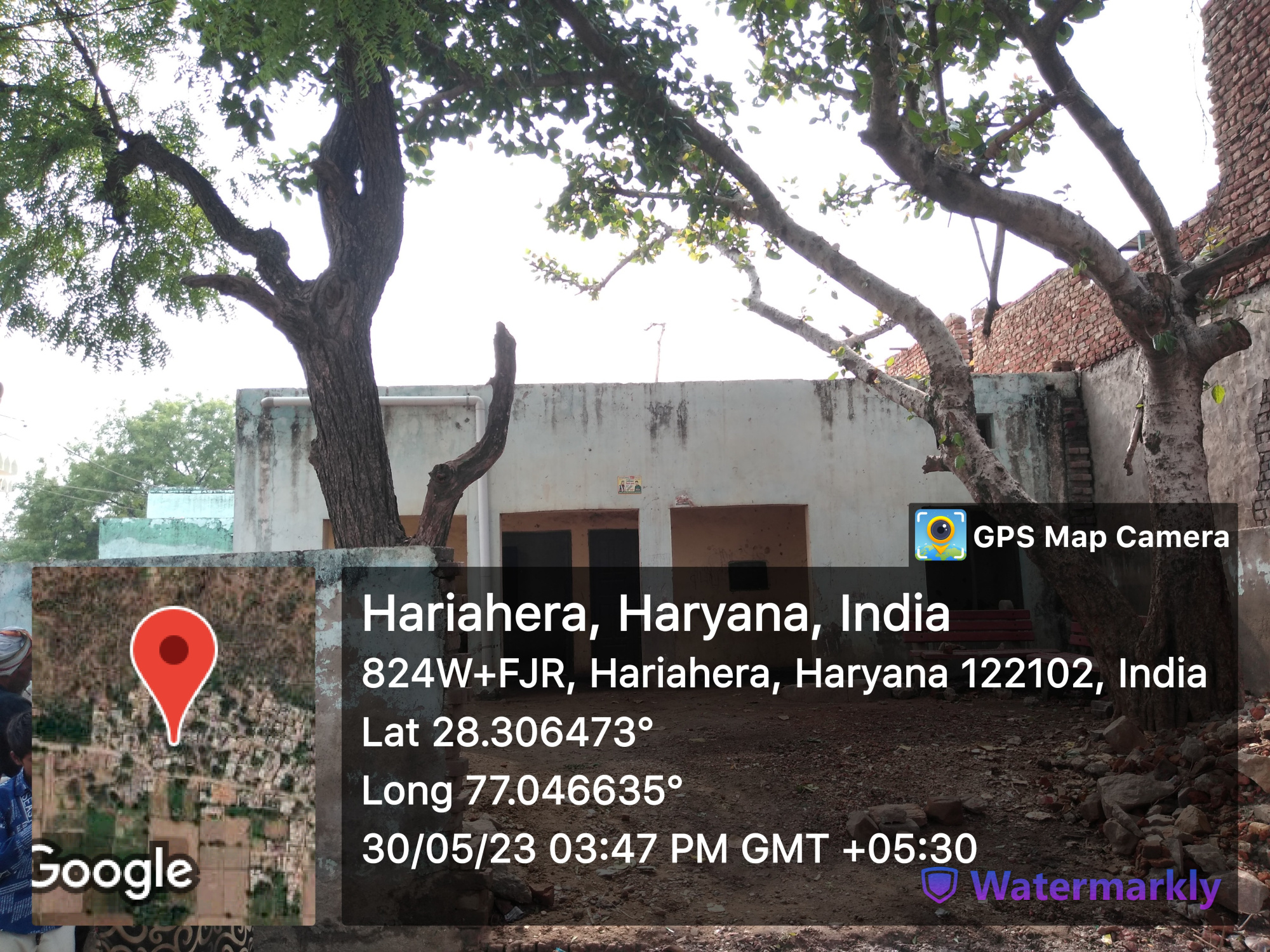
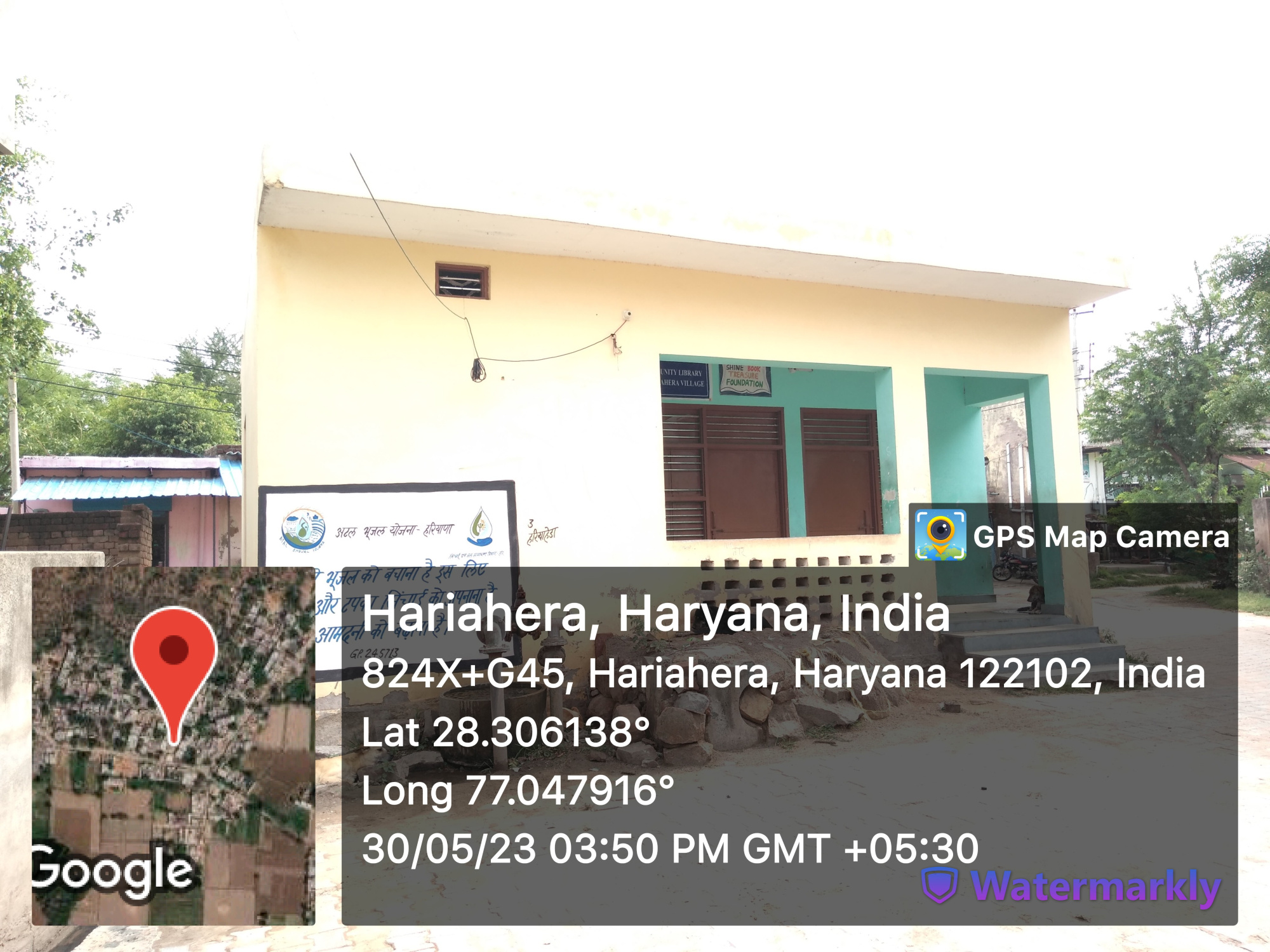
- S.C Chaupal
- V.C Chaupal
- Death rituals

- - Shamshanghat
- 1
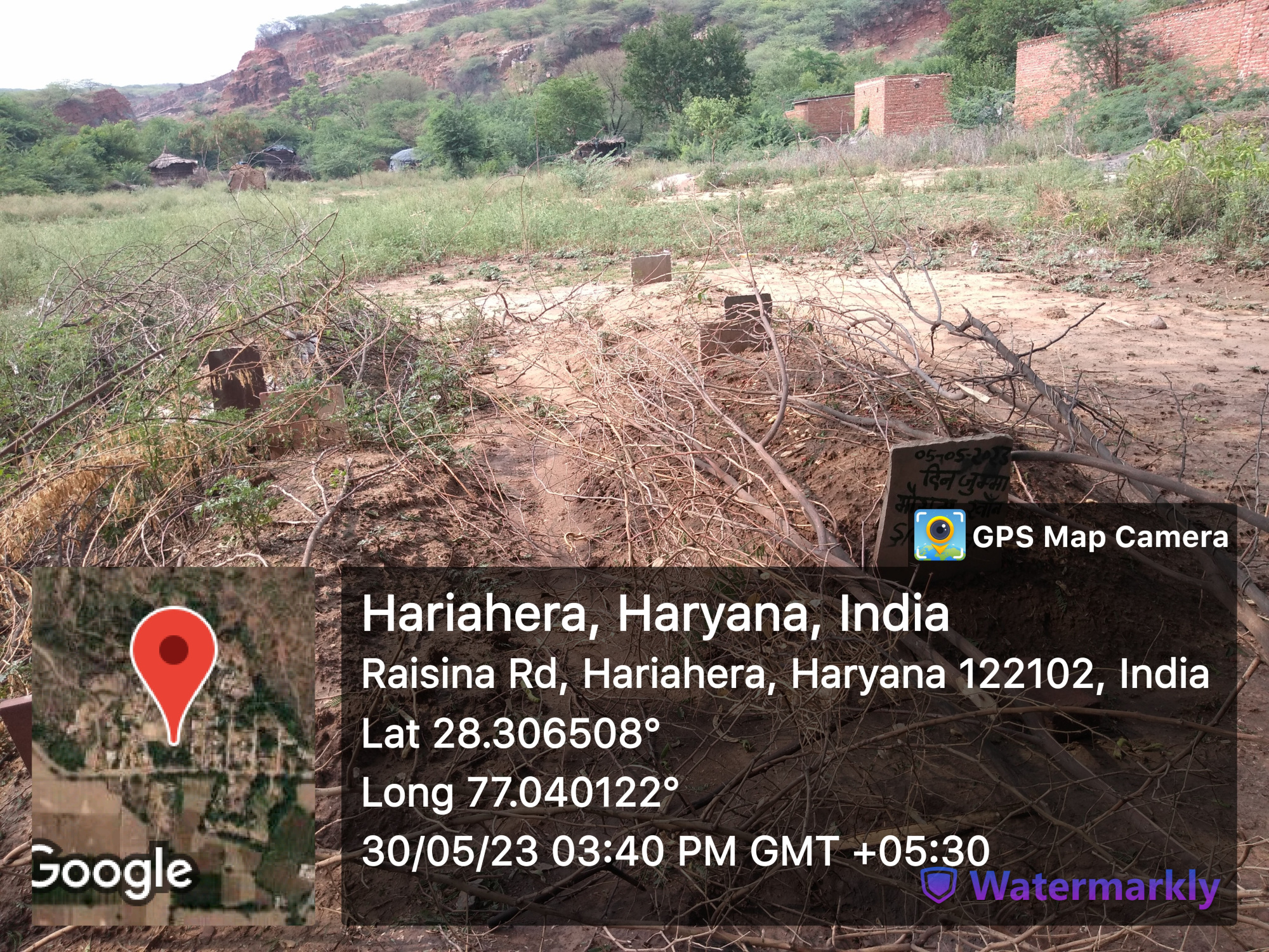

- - Kabristan
- 2
- Religious Places
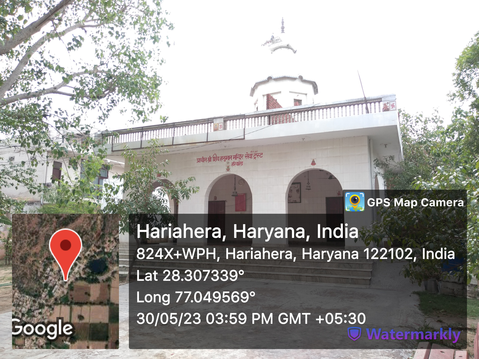
- - Mandir
- 1
- - Masjid
- - Church
- - Gurudwara
- - Khera
- Layout plans
-
- Stadiums
-
- Parks
-
- Gyms
-
- Library
-
- Mobile Towers
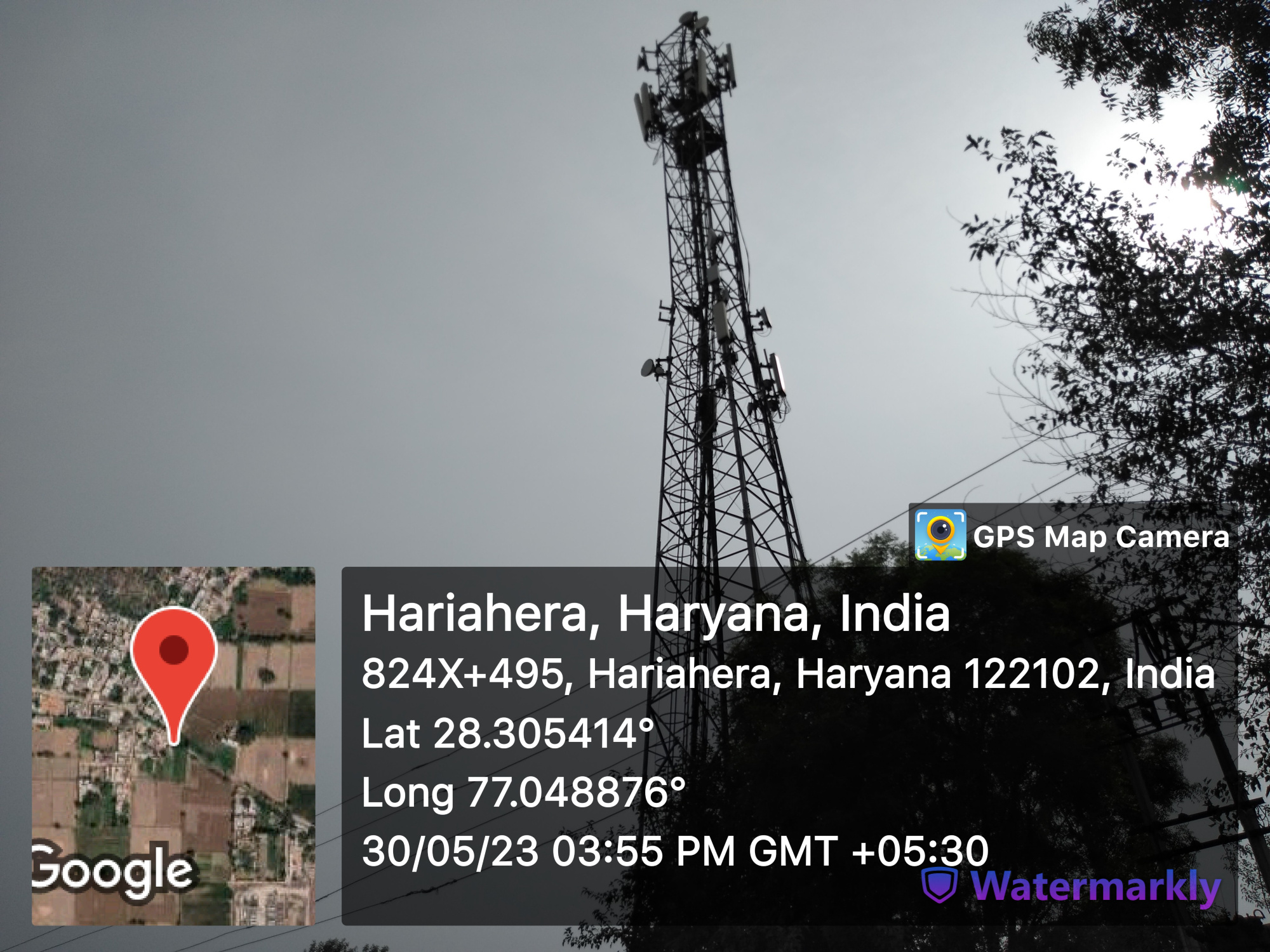
- 1
- BharatNet
-
- Substation (Electricity)
-
- Electricity Poles
-
- Industrial Infra
-
- Post offices
-
- 2
Education


- Anganwadi
- - Anganwadi Incharge
- 2
- - Anganwadi Code
- 501, 502
- - Anganwadi Staff
- 501: Mrs. Rajita
- 502: Mrs. Rajkumari
- - Anganwadi Strength
- 14, 12
- - Anganwadi Helper
- Mrs. Jamsheela
- Mrs. Savitri
- Primary School


- 1(Girls)(boys)
- Principal: Mrs. Suman Dahiya
- Teacher: 4
- Mrs. Chandni
- Mrs. Neetu Singla
- Mrs. Poonam Rani
- Mrs. Meenakshi yadav
- Total Strength: 85
- Chowkidar: Mr. Prabhu Dayal
- Secondary School

- 1
- Principal: Mrs. Suman Dahiya
- Teacher: 5
- Mrs. Suman Dahiya
- Mr. Parmod kumar
- Mrs. Gurmeet Kaur
- Mr. Suraj Bhanshastri
- Mr. Parvesh kumar
- Total Strength: 115
- Colleges
-
- Tuition Teachers
-
- ITI
-
- University
-
- Coaching Centre
-
- Student Profile
-
Industry
- Type of Industries based on size
-
- Type of Industries based on domain / product
-
- Work force Type
-
Health
- Hospitals
-
- Dispensaries
-
- CHC
-
- PHC
-
- Sub-health centers
-
- Facilities
-
- Medical stores with Timing
-
- Chemist shops
-
- Colleges
-
- Mal-Nutritions Data
-
- Pregnant Women Data
-
- Juvenile Committees
-
Banks
- Banks with branches
-
- ATMâs
-
- Financial Institutions
-
- Non Financial Institutions
-
- Business Correspondents
-
Social
- Old Age Pension
-
- Disabled Pension
-
- Scholarships
-
- Ration Card
-
- BPL Card
-
- Chirayu Card
-
- ESI Card
-
Bio Diversity
- Flora Species
-
- wheat, bazra, mustard
Commercial / Business
- Shops
- - General Store
- - Hardware
- - Seeds
- - Grocery
- - Textile
- Showrooms
-
- Warehouses
-
- Cold Storage
-
- Courier/Postal
-
- pin: 122103
- Resort/Hotel
-
Supply Chain Management
- Hafed/Other
-
Aquifer Information
- General Information
- - Geographical area :
- - Basin/Sub basin :
- - Principal Aquifer system :
- - Major Aquifer System :
- - Normal Annual Rainfall :
- Aquifer Disposition
- - Aquifer Disposition :
- - Status of GW Exploration :
- - Aquifer Characteristics :
- - CGWB Monitoring Status :
- - GW Quality :
- - Aquifer Potential :
- Aquifer Management Plan
- - GW Management Issues :
- - GW Resource :
- - GW Stage of Development (%) :
- - Existing and Future Water Demand :
- - GW Management Plan :
- - AR & Conservation Possibilities:
How to reach?
Source links on below
| Place | Type | Lat-Long | Link |
|---|---|---|---|
| Ponds | Wet | 28.30786276687813, 77.05065474759715 | https://goo.gl/maps/4qoFLB9zDueuhqTx9 |
| Dry | 28.30607511225958, 77.04127216371919 | https://goo.gl/maps/zCgiVKzqMJ5pqNBR8 | |
| Streets | Kacchi | - | - |
| Pakki | - | - | |
| Land | - | - | |
| Assets | - | - | |
| Buildings | 28.30646253652179, 77.0465872766935 | https://goo.gl/maps/KxYWonLT65Z64JkX8 | |
| 28.306069261965366, 77.0479812923901 | https://goo.gl/maps/YrFqRYufL4kg2ows6 | ||
| Death rituals | Shamshanghat | 28.308788654827012, 77.05178241138105 | https://goo.gl/maps/hQ7C6X3e2Qy987w86 |
| Kabristan | 28.306501216126172, 77.04011503863342 | https://goo.gl/maps/gxbHcBTbswxf3Mzg9 | |
| Religious Places | Mandir | 28.307281074025585, 77.04932851770752 | https://goo.gl/maps/PUpAeR1QTbZN7CAZ6 |
| Masjid | - | - | |
| Church | - | - | |
| Gurudwara | - | - | |
| Khera | - | - | |
| Layout plans | - | - | |
| Stadiums | - | - | |
| Parks | - | - | |
| Gyms | - | - | |
| Library | - | - | |
| Mobile Towers | 28.30526952818239, 77.04871062984031 | https://goo.gl/maps/FUc9DNda4Lgw3Xyq7 | |
| BharatNet | - | - | |
| Substation (Electricity) | - | - | |
| Electricity Poles | - | - | |
| Industrial Infra | - | - | |
| Post offices | - | - |
Village Requirement Hariahera
| Sr.No | Requirement Description | Published Date | Quantity | Estimated Amount | Requirement Applicable | Status |
|---|---|---|---|---|---|---|
| 1 | ||||||
| 2 | ||||||
| 3 | ||||||
| 4 |